The day breaks with clear skies and the sun filtering it's way through the trees to our RV windows. Patty takes a picture of our view... We rise early, taking to heart the suggestion made to hikers in the canyonlands...get your hiking done before 10:00am or after 4:00pm. Even though it is still early in the season, we are blessed with unusually warm and sunny weather, so the sun really gets intense in the middle of the day. And because of the terrain we're in, there is often little to no shade in which to get respite.
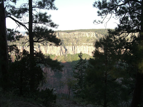
Our plan this morning is to drive the 1.5 miles to the North Kaibab Trail trailhead, then hike the 3.5 miles down and in to a place called Eye of the Needle. The hike, like those at Bryce Canyon, is first a descent into the canyon, then the return trip is all uphill. The total elevation loss going down is about 2,400 feet...which means that the climb put is also 2,400 feet...for those of you who love the math story problems that occasionally pop up in our posts, that's 2,400 feet of climb in 3.5 miles which is one foot of climb for every nine feet of distance, or an 11% grade...doesn't sound like alot, but it is. We arrived at the trailhead a little after 7:00 am and the parking lot was already nearly full. As we get started at the trailhead, we see one of the very creative approaches to keeping our parks free of plastic water bottles...a very attractive water spigot that talks about the great spring water here...very effective, it makes you want to go over and read it and play with the spigots! We'll post a photo in our next post...
One of the options here at the North Rim is a mule ride down into the canyon. The mule trail joins the main trail just a few yards down the trail, and they give you a few pointers about how to share the trail with mules. It is a little intimidating to have a mule train literally breathing down your neck as you hike (quickly) down the trail, but after a little while we have outdistanced the mules and can turn back and look up the canyon and spot them making their way down.


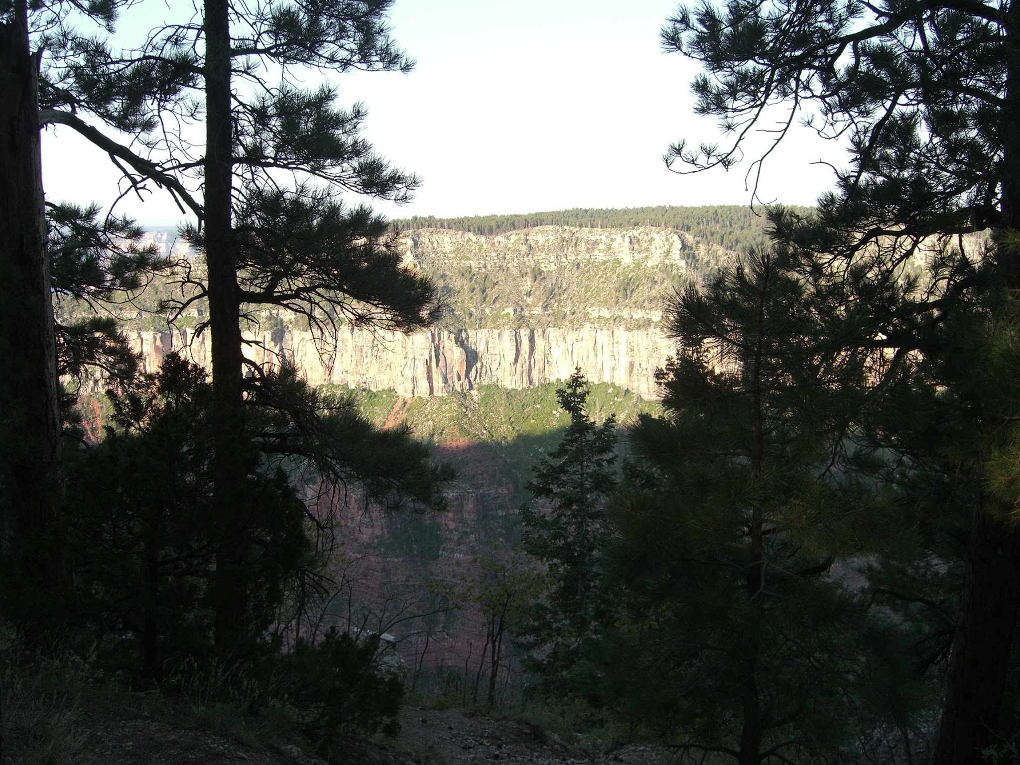
Ahh, nothing like the smell of mule dung in the morning...it smells like history... We make our way down the trail and are greeted with a different scene than that of Bryce or Zion. We start out in trees and wind our way down through the layers of rock which you can't help but feel are also the layers of earth's history. Each layer has color and texture that distinguishes it from those above and below. And here's an interesting fact we have picked up on earlier trips to Bryce and Zion...the top layer or rock here at the Grand Canyon is the bottom layer of rock at Zion; and the top layer of rock at Zion is the bottom layer of rock at Bryce Canyon. That's why they call this area the Escalante Staircase, because these are like the three big steps in an expansive staircase.

As we make our descent, we begin to realize what the return ascent will be like, and Michael looks for markers that will give us encouragement as we make our way back. First spots a metal tray-like structure which is close to the trail head, then some time later a stack of rocks that is bright white...which he names The Rock Stack of Hope. We'll be looking for these on our way back
The first formal viewpoint is the Coconino Overlook...a little less than a mile down into the canyon...named for the rock layer where it sits.
A couple scenic shots during our descent...
The next major point on the trail is the Supai Tunnel which serves as the stopping point and turnaround for the mule trips from the rim. We happened to see two horses taking a break. As the name would suggest, this point features a natural rock tunnel through which you pass to reach the lower reaches of the canyon. It also provides a rest stop for hikers who may be making their way all the way to the river at the bottom of the canyon...compete with toilet and drinking water.
After passing through the Supai Tunnel, you immediately notice that the trail has changed from a pulverized fine dust, about the consistency of confectioners sugar, to dirt and rocks. This lower portion of the trail is less traveled, and mule trains do not come this far down. Just a few switchbacks down the trail you can see the Redwall Bridge, a short bridge that spans a narrow but deep chasm of rock. It is called the Redwall Bridge because it rests at the Redwall level of the stone layers in the canyon.
Along the trail we pass day hikers as well as overnight campers who are making their way down to or up from the camp site which lies down at the base of the canyon, a total of 14 miles down (or up!). We pass over the bridge on our way to the Eye of the Needle...
We make it to the Eye of the Needle, a rock formation the vertically marks the canyon wall. It looks like a needle from a distance due to the long vertical scar that leads up to a huge round cave-like indentation. We hiked into the eye and sat down for a little snack before tackling the uphill return trip. It is getting warmer, much warmer.
We began our ascent and we immediately feel that the sun will be what we will work against...it is so intense. We slowly make our way up and up and up...it's dry, hot and dusty...and honestly, it did not seem this steep on the way down! Michael stops to try to figure out how to tap into the water pipe...where's the faucet?!
On the way back across the Redwall Bridge we have it all to ourselves, and the sun is just right to catch our shadows on the rocks below...hey, lady, watch your hands!
Along the trail up to the rim, we see these names etched into the rock...apparently our in-laws have been here...hey, Dave and Nate!...who the hell is Joe?! And how did you get ahead of us?!
Ok, it really hot...we probably should have started this hike about an hour earlier...that sun is relentless and we're taking advantage of the small patches of shade that are very few and very far between. We found this one great spot that provided shade and an unusually cool breeze from above. We look and realize why...there is a small slot fissure directly overhead and the air passing down through it picks up the cool of the shaded rocks wedged in the crack. Wait a moment, now that we think about it, this probably is not the safest place to stop! Time to move on.
We are focused on the familiar stretches of the trail that we remember from the descent, trying to calculate how much further to the trailhead...wait...there it is..the Rock Stack of Hope! We're getting close...!
And there's that metal tray thingy...oh thank God, we can get out of the sun soon!
We drove back to the campground and find that our friends Sue and Fletcher have arrived to share our site for a couple of nights. We were supposed to have left them a note about our whereabouts but forgot. Fortunately they saw our RV in the trailhead lot as they drove into the campground.
We clean up, hydrate and set up our photos for our blog post. Tonight the four of us will drive to the other side of the park and take our picnic dinners to the very edge of the canyon for sunset...stay tuned for what is supposed to be the best view in the park!
Miles hiked: 7 miles. Travel time: 3 hours. Bugs killed: stepped on a few flies around the mule dung piles.


I like your account of the hike and the photos. We just hiked this trail down to Cottonwood campground. But I didn't know where the eye of the needle was.
ReplyDeleteThe first campground is actually only 7 miles up or down - Cottonwood Campground. Bright Angel Campground is 14 miles from The North Rim, but most hikers are coming from or heading to Cottonwood from The North Rim.
ReplyDelete