July 27, 2012
Well, this morning is very different from yesterday...it is cold, the clouds are so low there is a heavy mist in the air, and we wondering whether we'd be able to see anything if we went up the mountain to Sunrise which is several thousand feet higher than we are now.
So, we decide that since we have another day at Mount Rainier we will wait till tomorrow morning to go up to Sunrise, and this morning we will head into Packwood in search of Internet access.
Now, by way of background, the method by which we are blogging involves two iPads. We use Michael's iPad as the primary repository for photos, and Patty sorts through the daily pictures and selects a reasonable number of photos that tell the story of our day to create an album. We then upload that album to Picassa via an Internet connection, and once the photos reside at Picassa they are available to us to drag into our blog post. Michael uses Patty's iPad for the actual writing and editing of the blog post since the other iPad is generally busy working on pictures, and we have a app that let's us compose our blog writing offline.
So, we drive into Packwood and find a coffee shop that has Internet access...that means we're all set to start uploading pictures for future posts, and Michael can drag photos into the posts he has written and then post them for our (small but) adoring audience. It is at this moment that Patty's iPad decides to give up the ghost...yup, it develops what we find out later is a rare but critical hardware failure that eliminates its ability to connect to wi-fi.
Really?!!! Are you kidding us?!!! For all intents and purposes we're shut down until we get home and figure this problem out...we don't have a 3G cellular connection and even if we did we can't afford the time (or the data usage) to try to upload photos and post blog entries via cellular data...
argh! Now we're really going to have a lag in blog posts...sorry folks...!
Time to cut our losses and move to Plan B...let's find a hike or two to do...maybe it will take our minds off of our blogging challenges...Fortunately there are lots of picturesque places at Mount Rainier, so it shouldn't be any big deal to choose something nice. Besides, on the drive back from Packwood the sun decides to come out...!
Here at Rainier there is a place called the Grove of the Partiarchs. It is a small island sitting in the middle of the Ohanapecosh River on which a grove of huge first-growth trees exists virtually untouched, and it is an easy, short, flat loop trail that we can get in before lunch.
Even before we cross the river to the actual Grove we walk among giant trees and only really get the full impact of how big they really are when we walk right up to them...
This is a very popular trail due to how easy it is for everyone to walk it, so the park service has placed a number of informational signs along the way explaining different facets of the forest and these huge trees...
As we mentioned, the Grove of the Patriarchs is located on an island in the Ohanapecosh River, so we have to cross a suspension bridge to get to the Grove...it's a very bouncy bridge, even when just one person is on it...and some folks don't read the "one person at a time" sign (or don't think it applies to them), but we manage to get the system back on track...Remember the flooding rains in 2006 we talked about earlier? Well, this bridge was destroyed by the river and the debris racing along with the floodwaters, so it is practically new!
As soon as we enter the Grove, we come upon this huge base of an uprooted tree. (It's kind of funny, we have a photo almost identical to this from a trip we made here ten hears ago...) This is the root structure of a tree that toppled in 1970...it was many hundreds of years old, and you can see how large it is compared to Patty...
Once we are inside the Grove of the Patriarchs we are struck by the scale of these trees...it is hard to capture the feeling on camera, but we'll try...The loop path through the Grove is a boardwalk so that visitors do not tread on the roots of these majestic trees (and wander other places where they are not supposed to)...
How's this for a good-sized tree?
The Park Service tries to leave this island as untouched as possible in terms of toppled and dead trees because it allows the natural cycle of life in the forest to continue. The cycle is explained in a sign, and we can see a living example right here...a dead tree becomes the foundation for new growth...
...and as huge as these trees are, when one serves as the foundation for new growth there is alot of opportunity for new growth! This was one very tall tree...!
The next natural wonder on the Grove loop is a pair of Douglas Fir trees, each of which are 1,000 years old or more. Think about that...these trees were 100 years old when the Knights Templar were founded, they were still young when the Magna Carta was signed and when Machu Picchu was constructed, they were here during the landing of Christopher Columbus on the continent, the French and Indian War, the French and American revolutions, the Civil War, the Industrial Revolution, Washington Statehood, and everything since...They have seen better days, the inside of the trees is rotted out and one is missing a top,but they are still alive and most impressive...
OK, we said that we couldn't really capture the magnitude of the Grove or the grandeur and stature of these giant trees, but here's an attempt...if you look really
really hard you can see Patty among the trees in the center of this photo...honestly, this is not an altered photo, the trees are that big!
Here's another photo we hope gives a sense of the size of these trees...this is a toppled tree, and Patty is standing about two-thirds of the way along the trunk toward what was the top of the tree...you have to look hard, she's there, by the railing...
On the way back toward the river and the return trip on the Grove of the Patriarchs trail we catch this sign that we did not see on the way into the Grove...remember the large upturned tree with the roots showing (and Patty standing in front of it)? Well, this sign explains that there were two trees whose roots were mutually supporting each other as they grew side by side. In a storm in 2006 these trees topped, and headed in opposite directions due to the loss of support from each other. What's left are the two root structures on opposite sides of the trail, the roots on the left are being overgrown by the forest, and a new tree has decided to grown right up between the vestiges of the two toppled giants....pretty amazing...
As we cross the suspension bridge on our return trip we take a moment to enjoy the river as it rushes beneath us...
OK, now it's time to get back to our campground for lunch...and we decide to do a little housekeeping on our way back. There is one part of our camping experience we have not shared before (though we've referred to it with euphemisms) and that's what's know as "dumping"...yes, it is what you think, kind of. Our RV has three tanks built in...one for fresh water, one for "gray" water (from the sink and shower), and one for "black" water (from the toilet). So we decide to "dump" before getting back to our campsite, and there is a dump station at our campground (well away from camping sites..) so we pull up and empty the gray and black tanks. Believe us, you do want to wear rubber gloves when you do this...just in case...
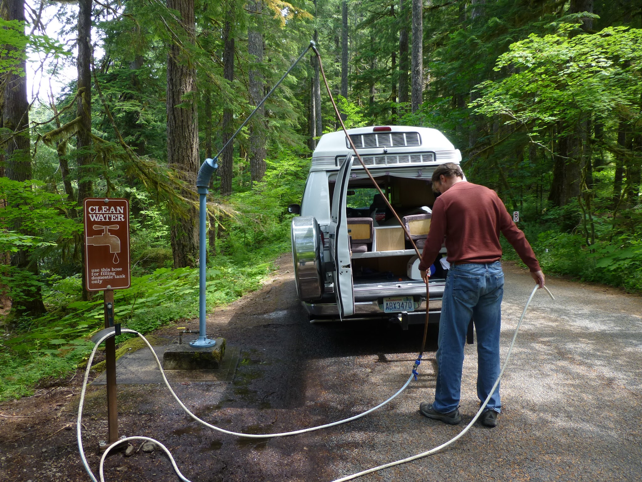
Then we throw a little more fresh water into the fresh water tank...our filler hole is in the door frame of the rear door...nearly all dump stations will have a spot for dumping tanks and a separate spot for taking on fresh water.
What's great about parks in Washington is that nearly all have recycling, so we offload some recycling (where did all those wine bottles come from?).
After lunch we decide to go for another hike (since the Grove was amazing but not that strenuous) and have chosen the Silver Falls trail that starts right in the Ohanapecosh campground. On the way to the trailhead we stop on the bridge that runs across the river, and it is still rushing with snow melt. Some kids are taking part in a traditional Ohanapecosh activity...jumping from a huge boulder into the frigid water below (then paddling like hell to get to shore and get out!)...
The start to the trail is not hard to find...most trails don't look like a sidewalk like this one does. But it is a very popular trail because it also leads to the hot springs...on our way by, we decide to take a look at the hot springs...we read a little bit about them in the Visitors Center, so we're interested to see them ourselves.
The river is just so beautiful in the midday sun, and the rushing water so impressive, that we have to stop to take a picture...
A right turn and a short uphill walk gets us to the first sight of the hot springs and some background information. It seems that in the 1920's people were really in to resorts and retreats for cures to their maladies, and hot springs were supposed to be curative for all sorts of ailments and conditions. The resort here was open until the early 1960's, and today there is no sign of the buildings that were the resort.
The lower portion of the hot springs runoff colors the ground a tint of yellow, and the water is only lukewarm...
Further up the hill toward the actual hot springs the water collects in small pools and is pretty warm. Due to the minerals in the water as well as the temperature, the pools have some eerie colors to them...greens, yellows, oranges...
Back on the trail and headed toward Silver Falls we come across the Washington State mascot...the slug. This guy is big, black and supremely confident...he thinks he can get across this dry dusty trail without getting stepped on or drying out...
The Silver Creek trail is a loop that goes up one side of the Ohanapecosh River and down the other side...and along the way it crosses smaller creeks that feed into the Ohanapecosh. This is the Laughingwater Creek...hahahaglugglugglughahaha...
...really, that's what it's called...see?!
This trail is turning out to be quite a nature walk...we've never seen one of these before...we think it is a centipede...he too is an optimist as he traverses this popular hiking trail...
We reach our destination, Silver Falls, and there is some serious water cascading over the falls. The water in this river just looks cold...it is a pale icy green with a hint of gray...Because so much water is flowing over the falls, there is alot of mist rising in the air...
A bridge crosses the chasm jammed with boulders where the river continues to fall as it makes it's way to our campsite!
It's really a beautiful, narrow channel through the trees and rocks downstream...
On the other side of the river the trail winds it's way along the river bank which is a rocky ridge...here the trail passes under a huge rock outcropping...we pause (but only briefly!) to capture a picture, then scurry out from under this mass of granite...
The rest of the trail was smooth sailing and returned us to the opposite side of the river in our campground. So we clean up and begin our cocktails-dinner-campfire ritual...and, of course, where there's fire there's s'mores...
Evening falls and we take a walk around our campground....picking out the good campsites for our next visit!
Tomorrow we will get an early start and head up the mountain to Sunrise...and hopefully some great hiking with views of Mount Rainier, fingers crossed!